Geographic Datatypes
There are different geographic data types available in pimcore: Geopoint, Geobounds, Geopolygon and Geopolyline.
The country select box also belongs to the context of geo widgets, but it is rather a select input widget and therefore it is
listed with the other select widgets.
Geopoint
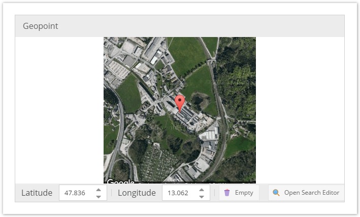
The geopoint consists of two coordinates: latitude and longitude. In the Pimcore GUI there is the same geopoint selector
widget as shown above. It allows to find coordinates for a geographic point easily. In the database the values are
stored in two columns which are called latitude and longitude. Programmatically the data for this field is
represented by Pimcore\Model\DataObject\Data\Geopoint. To set a geopoint programmatically, a new
Pimcore\Model\DataObject\Data\Geopoint has to be instantiated:
$longitude = 107.6191228;
$latitude = -6.9174639;
$point = new \Pimcore\Model\DataObject\Data\GeoCoordinates($latitude, $longitude);
$object->setPoint($point);
$object->save();
Geobounds
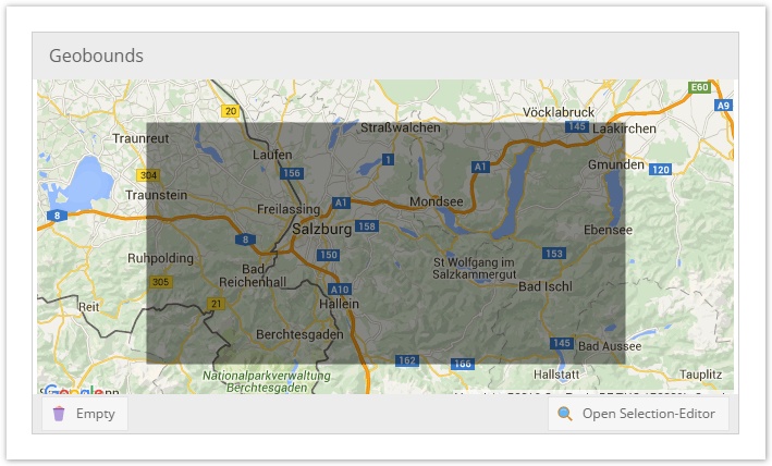
Geobounds represent a geographic area defined by a north eastern point and a south western point. In the pimcore GUI the
input widget as shown above is available. In the database there are 4 columns with coordinates to hold the data of
geobounds. Programmatically both points are Pimcore\Model\DataObject\Data\Geopoints and they are wrapped by the
Pimcore\Model\DataObject\Data\Geopoints Object. The following code snippet shows how to set Geobounds:
use Pimcore\Model\DataObject\Data\Geobounds;
use Pimcore\Model\DataObject\Data\Geopoint;

$northEast = new \Pimcore\Model\DataObject\Data\GeoCoordinates(150.96588134765625, -33.704920213014425);
$southWest = new \Pimcore\Model\DataObject\Data\GeoCoordinates(150.60333251953125, -33.893217379440884);
$object->setBounds(new Geobounds($northEast,$southWest));
$object->save();
Geopolygon
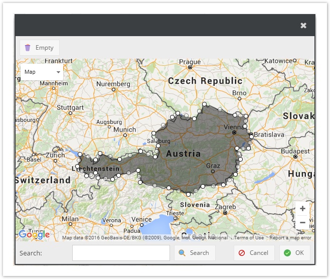
The geopolygon is the third in the row of geo widgets. It allows to define a geographic area by setting an arbitrary
amount of geo points. In the database these points are stored in a single column of the data type LONGTEXT in the
form of a serialized array of Pimcore\Model\DataObject\Data\Geopoints. To set geopolygon data programmatically, an
array of Geopoints has to be passed to the setter:
use Pimcore\Model\DataObject\Data\Geopoint;

$data = [
    new \Pimcore\Model\DataObject\Data\GeoCoordinates(-33.464671118242684, 150.54428100585938),
    new \Pimcore\Model\DataObject\Data\GeoCoordinates(-33.913733814316245, 150.73654174804688),
    new \Pimcore\Model\DataObject\Data\GeoCoordinates(-33.9946115848146, 151.2542724609375)
];
$object->setPolygon($data);
$object->save();
Geopolyline
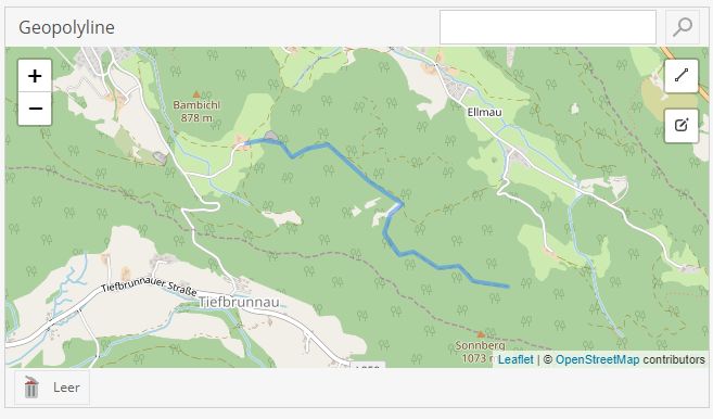
It allows to define a geographic path by setting an arbitrary amount of geo points. In the database these points are
stored in a single column of the data type LONGTEXT in the form of a serialized array of
Pimcore\Model\DataObject\Data\Geopoints. To set geopolygon data programmatically, an array of Geopoints has to be
passed to the setter:
use Pimcore\Model\DataObject\Data\Geopoint;

$data = [
    new \Pimcore\Model\DataObject\Data\GeoCoordinates(-33.464671118242684, 150.54428100585938),
    new \Pimcore\Model\DataObject\Data\GeoCoordinates(-33.913733814316245, 150.73654174804688),
    new \Pimcore\Model\DataObject\Data\GeoCoordinates(-33.9946115848146, 151.2542724609375)
];
$object->setPolyline($data);
$object->save();